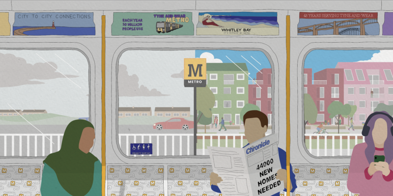
Metroland
Harper Perry, Urban Design Works, and Studio Mint with North East Combined Authority and NEXUS Tyne and Wear Metro
The Northeast region (metro area) is expected to deliver 44,000 new homes over the next ten years. Current planning allocations will see much of this housing developed on peripheral greenbelt land, with new road infrastructure to support the car-dependant lifestyles that it will create, and with huge consequences for regional net-zero targets.
Whilst other cities are grappling with the need to develop and expand integrated, low-carbon public transit systems to enable a transition away from private car use, in the Northeast we already have it. The Tyne and Wear Metro it is the second largest, light rail system in the UK (after Manchester). It connects two cities and six local authority areas and plans are being developed for its expansion to the north and south*. However, land around many of the 60 stations along its route are under-developed.
The Metro route has potential to be the nucleus for strategic new housing development that would benefit the entire Tyne and Wear region. Metroland could be a place of compact and bustling villages centres. New homes would draw on the familiar and enduring types of terraced houses and Tyneside flats to create dense and sociable neighbourhoods. These new metro villages would have metro links on the doorstep to carry people quickly and comfortably to work, college and university and have enough footfall to support shops and other services close to metro stations.
*Department for Transport Statistics (2021) Light rail and tram statistics, England: year ending March 2021
Harper Perry
James Perry, Architect/Planner
Claire Harper, Architect, Researcher
NEXUS
Helen Matthews, Corporate Planner
Urban Design Works
Rob Beardsworth, Urban Design
North East Combined Authority
Laurence Bonner, Combined Authority for Region/ Transport
Studio Mint
Ellie Gair, Architect/Researcher